Padina (Padina)
Padina (Падина; Padina) is a village in Serbia in the municipality of Kovačica. Majority of the population are Slovaks (96.78%).
Padina lies in the middle of South Banat, at the border of Deliblato's shoal, on 52.75 km2, and in a southeast-northwest course. Geographical width of village is 45°7' N and 20°44' E. Altitude is between 105 and 120 meters above sea level (the church is on 111 m). Its name means slope or downhill. Padina covers 13% of Kovačica municipality, that is parting of the ways of roads to Belgrade, Zrenjanin, Novi Sad and Vršac.
System of valleys surrounding Padina has two directions, which cross on southern part called BAUK. Northern part is called Upper valley (Horná Dolina), and southern - Lower valley (Dolná Dolina).
Characteristic of Padina are large differences between summer and winter temperatures and low precipitation. July is the warmest month with average temperature about 22°C, and January is the coldest month with average about -1°C. Divergence between the lowest and the highest absolutely measured temperature is 70°C.
The highest precipitation is in May and June and also in November and December. It totals between 650 and 700 mm of rain per year.
The wind, which often blows from southeast is called "koshava". Košava blows from Montenegro for one to seven days (or even longer) with a speed of 100 km/h. It is most frequent in spring and autumn. Northern wind is dry, like koshava, but much colder. It comes in winter months and brings the coldest and driest weather.
Underground water is being found in depths about 30 meters. On deeper places water is more clear, and people are supplied from there. The soil in Padina is muddy.
Map - Padina (Padina)
Map
Country - Serbia
 |
 |
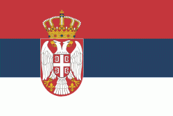
| Flag of Serbia | |
Continuously inhabited since the Paleolithic Age, the territory of modern-day Serbia faced Slavic migrations in the 6th century, establishing several regional states in the early Middle Ages at times recognised as tributaries to the Byzantine, Frankish and Hungarian kingdoms. The Serbian Kingdom obtained recognition by the Holy See and Constantinople in 1217, reaching its territorial apex in 1346 as the Serbian Empire. By the mid-16th century, the Ottomans annexed the entirety of modern-day Serbia; their rule was at times interrupted by the Habsburg Empire, which began expanding towards Central Serbia from the end of the 17th century while maintaining a foothold in Vojvodina. In the early 19th century, the Serbian Revolution established the nation-state as the region's first constitutional monarchy, which subsequently expanded its territory. Following casualties in World War I, and the subsequent unification of the former Habsburg crownland of Vojvodina with Serbia, the country co-founded Yugoslavia with other South Slavic nations, which would exist in various political formations until the Yugoslav Wars of the 1990s. During the breakup of Yugoslavia, Serbia formed a union with Montenegro, which was peacefully dissolved in 2006, restoring Serbia's independence as a sovereign state for the first time since 1918. In 2008, representatives of the Assembly of Kosovo unilaterally declared independence, with mixed responses from the international community while Serbia continues to claim it as part of its own sovereign territory.
Currency / Language
| ISO | Currency | Symbol | Significant figures |
|---|---|---|---|
| RSD | Serbian dinar | дин or din. | 2 |
| ISO | Language |
|---|---|
| BS | Bosnian language |
| HU | Hungarian language |
| SR | Serbian language |


